


IMPORTANT: This application is optimized to run on tablets and will not run on handset devices.
CHARTS Enjoy the same great detail you have on your GPS chartplotter! Award winning vector maps included in App price remain resident on your device so you can access them when outside internet coverage! Query chart objects anytime for descriptive details. Pan, zoom and measure distance.
ROUTES & TRACKSCreate and edit routes based on your cruising speed and fuel consumption. Record and view your tracks. Capture pictures (geo-tagged) along the way to create a virtual adventure log of your entire trip.
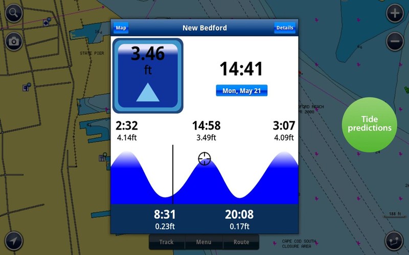
WEATHER & TIDES Quickly access up-to-date tide, current, wind speed/direction & sun/moon cycle information. Save your favorite locations. Consult wind forecasts and tide and current predictions while planning trips.
COMMUNITY EDITS 2,000 edits every day! Benefit from timely localized data contributed by the Navionics Community! Wrecks, obstructions, buoys, beacons, lights, and more are visible as soon as posted. Read reviews of marinas, repair shops, etc. Take advantage of this unique feature and be part of the community with your own contributions.
SEARCHAccess the largest database of marine POI’s available. Search by lat/long or category for Marina, Marine Repair, Boat Dealers, Waterfront restaurants, etc!
SHARE Email, Tweet or FB your routes, tracks, photos or markers! Your friends can learn about your day on the water by viewing the .kmz file you send them in Google Earth! It’s so cool!
MAP OPTIONS Overlay Google Maps, Bing or Terrain.
SYNC My Data – automatically sync your Markers, Routes, Tracks and Photos among all your mobile devices.
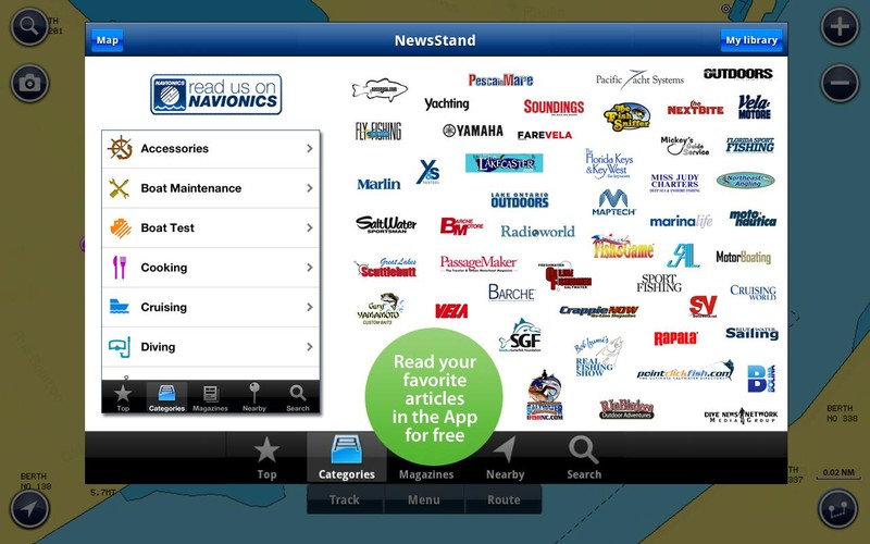
MAGAZINES & GUIDESDownload free articles from the world’s leading Marine publications! Geo-referenced and saved to a digital library for easy access anytime or anywhere!
IN-APP UPGRADES Navionics Apps allow you to access amazing add-ons:√ Advanced Map Options gives you even greater control of your map. Highlight Shallow Area, select Depth Shading, filter Depth Contours, adjust shoreline to selected Water Level, view Seabed composition (available for select US HD lakes) and toggle Fishing Mode to locate key fishing areas. √ Choose additional coverage anytime.
COVERAGE Please refer to screenshot above for chart coverage area contained in this app title. Please refer to Lake List on navionics.com. Does not include Bermuda, which can be found on Marine: Caribbean & South America.
Navionics has certified the following Android tablets with an OS of 3.0 or higher: MOTOROLA: XOOM MZ604, Asus eeePad Transformer TF101, Transformer Pad Infinity-TG700T, Nexus 7(1st and 2nd gen) SAMSUNG: Galaxy Note 10.1, Tab 10.1' GT-P7500, Acer Iconia Tab A501. ALL SALES ARE FINAL on Google Play store. Navionics apps are designed to load and operate correctly with all tablets with an Operating System of 3.0 or higher. However, we cannot guarantee flawless operation on non-certified Android devices. Navionics does not support any non-certified Android devices. Please check our App Description or go to Navionics.com for an up to date list of certified devices. Please refer to Navionics Mobile Android Tablets FAQs section.