


That is just a glimpse of the navigational power you will hold in your hands when you install Polaris Navigation GPS.
While this app is used mainly for offroad navigation and navigating trails, it can be used for city street navigation as well. This complete navigation package includes online and offline maps, a panel for all standard GPS parameters, odometers, altimeters, speedometers as well as waypoint and trail-navigation protocols. Also included in this immense tool-set:
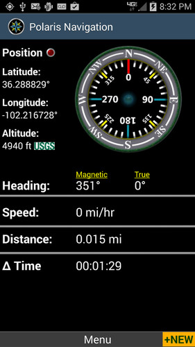
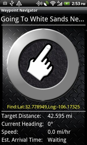
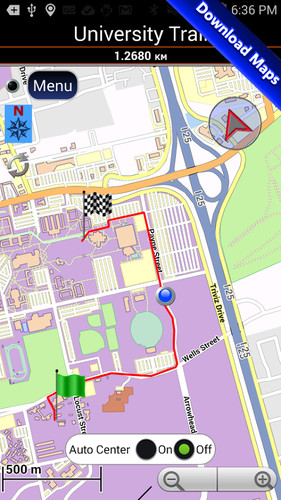
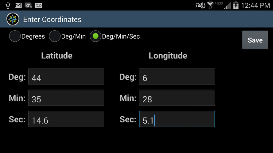
★ Download maps for offline use from our map library.★ No subscription fees. Does not require any special accounts.★ A Robust waypoint management system for setting and locating your targets. ★ Trail recording and viewing.★ Select map source (Google Maps, OpenStreetMap-Mapnik, Maps from Mapquest, Cycle Route Maps, Vector Maps).★ Cache map data based on OpenStreetMaps.★ App supports map atlases in mbTile format.★ GPS Satellite Diagnostics- satellite count, location and signal strength. ★ A waypoint navigation system which includes a dynamic waypoint-finding compass that will help you navigate to any saved waypoint with certainty while reporting estimated time of arrival, distance to target and other statistics. ★ Trail navigation system.★ Trail altitude profiles★ Email / SMS GPS location data including maps showing your position.★ Supports many coordinate formats including latitude/longitude as degrees, deg:min, deg:min:sec, and UTM coordinates.★ Military Coordinate Finder - Uses Military Grid Coordinate Reference System (MGRS).★ Customizable unit reporting including support for marine navigation.★ Select source for altitude reporting: Satellites, United States Geologic Survey or Mapquest's Altitude Service.★ Turn-by-turn voice directions and route maps are included for street navigation.★ Data protection System- Your data is backed up regularly meaning you will not lose your progress should your battery need replacement while en route to your destination.
★★ A Great Navi GPS for Hiking, Boating, Fishing, Hunting, Geocaching, Camping, Sailing, Mountain Biking or wherever your outdoor activities take you!
★ Additional Screenshots at: http://www.gps4free.com ★
This app receives frequent free upgrades. Recent upgrades delivered to our users:- Map library with maps for over 400 countries and states.- Waypoint Calculator- Background Trail GPS recording option.- Added auto-center controls to trail navigation screen.- Added magnetic compass sensitivity controls.- Send waypoint and trail data directly to GPS Waypoints Navigator- Waypoint photography- CREATE MBTILES BASED MAPS FOR OFFLINE NAVIGATION. INSTRUCTION VIDEO AT: http://www.youtube.com/watch?v=Y3RtFvPna1A- Added Map Search and Coordinate Conversion capabilities with the new MapIt plug-in.- Maps now viewable in landscape mode.- Added MGRS (military grid reference) coordinate system and power saving options.- Offline maps and alternate map sources for backcountry navigation.- UTM Coordinates- Improved compatibility for marine navigation with addition of nautical units and coordinates-Multiple altitude sourcing- Satellites, US Geo Survey and Mapquest.