


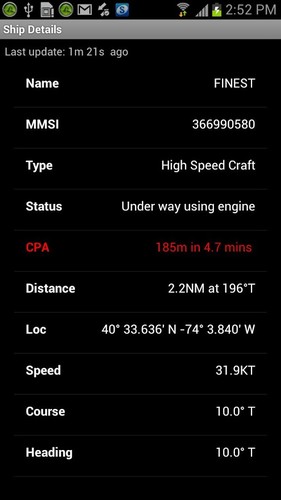


Specifically designed for use on the water, BoatBeacon uniquely provides Bearing, Range and Closest Point of Approach (CPA) calculations in addition to AIS ship information. Uses up-to-the-second AIS feeds unlike other apps which can be a minute or more behind real time. Transmits as well as receives AIS and is the only app that continuously monitors CPA, notifying if potential collisions are detected even when the app is in the background.
Outstanding ★★★★★
“An outstanding app, with great potential. Both interesting to use and very user friendly. This could be a life saver. Everyone who goes on the water should have this on and use it!” Sundream
Key Features------------Receives AIS ship data in real-time. No VHF AIS receiver, transponder or aerial required.
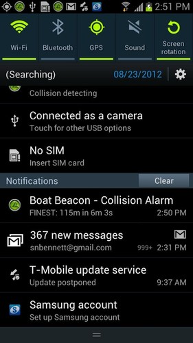
Over the horizon Collision, SART and MoB detection (30 miles radius) using continuous Closest Point of Approach (CPA) calculations - highlights boats that are on a potential collision course and alarms.
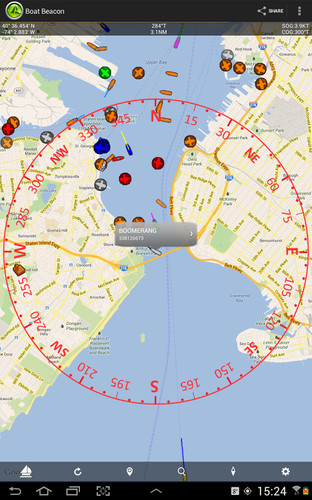
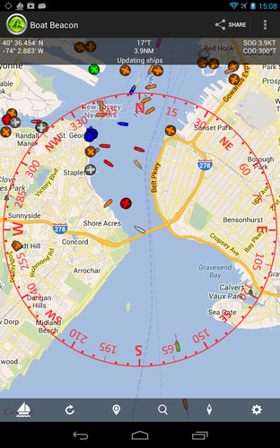
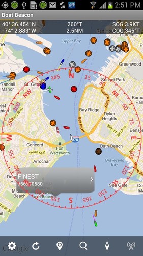
Provides Bearing and Distance information to other boats in addition to AIS information like speed, course, location, name, length etc.
Continually calculates and alarms CPA even when the app is in the background.
Option to Transmit your boats position, speed and heading to Global AIS Systems and other Boat Beacon users. Transmit also works continuously in the background too when enabled.
Live Map view with compass overlay which rotates with you so you can look in the direction of the ships on the map to locate them.
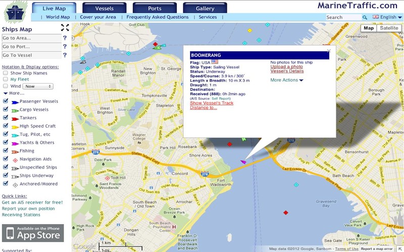
Extensive details on other ships - including Photos.
Search for boats or places nearby or worldwide by name or MMSI.
Share your track and position with friends and family instantly and in real time via email, Twitter and Facebook etc.
People can also follow you on Boat Beacon and leading AIS systems like MarineTraffic, ShipFinder and AIS Hub which have free web viewers available.
Also supports NMEA AIS via Wifi and USB.
Arm all the crews in a race with Boat Beacon and have real time updates on the race positions and have the Club-house watch too on a large screen with Boat Beacon's TV/Video Out support
Keep a watch and in touch with other boats in your flotilla when sailing in a group.
Ideal for busy and popular harbours, ports and coastal areas upto 15 miles out to sea.
Boat Beacon requires internet access to work. Most popular coastal areas in the US have cellular data access extending 12 or more miles out to sea. The UK has nearly complete coastal coverage out to 12 miles. AIS Ship data is provided by a network of voluntary AIS shore based stations. Some areas may not have AIS coverage.
N.B. This is not an AIS transponder. You will not be visible to other ships on their AIS systems unless they also use data from the same land based AIS networks.
Requirements:Android Smartphone or Tablet with GPS.Internet connection.
You do not need an MMSI to use Boat Beacon and you can be seen on Boat Beacon by other Boat Beacon users without having one. However if you want to be seen on Global AIS systems like Marine Traffic, ShipFinder and AIS Hub, etc. then you will need to have and use an MMSI number. If you don't have an MMSI for your boat you can obtain a free one in the US in a few minutes by visiting http://www.boatus.com/mmsi (the USCG approved agent) and using their online form. Alternatively email us for a free internet MMSI number.
Please note that continued use of GPS running in the background can dramatically decrease battery life.
NOT FOR NAVIGATION
This program is distributed in the hope that it will be useful. Boat Beacon should only be used for basic navigation reference and should not be solely relied upon to determine precise locations, proximity, distance, or direction.