
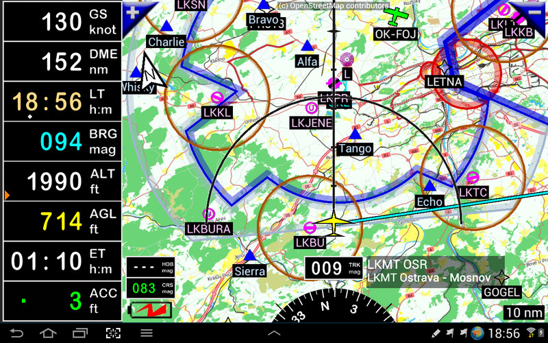


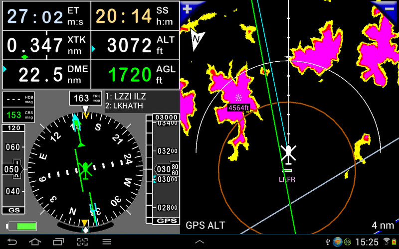
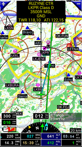


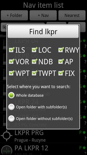
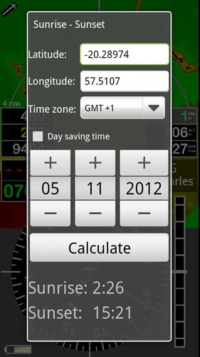
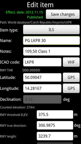


- This software provides ILS approach and GPS, VOR, NDB, DME, Marker beacons, RNAV navigation and Marker beacons warnings without ILS/VOR/NDB/RNAV equipment on board. This application is completely autonomous.- Warnings before entering to the controlled or special use airspaces- Automatic and manual Logbook. The Logbook records:a. flight track (it is possible to export it to the .kml file (Google Earth) or .gpx file)b. departure and arrive airportc. departure and arrive timed. aircrafte. pilot(s)- Virtual radar - users can see another aircrafts in the air.- Dynamic terrain map (colors depend of height above ground level), obstacles- Free topographical map. Maps can be created by users using MOBAC, SAS PLANET or RMAP applications- Free World navigation database- Airspace- Route planning, calculation of fuel consumption (depended on wind)- Barometric altitude and vertical speed indicators – (requires your device to have a barometric sensor)- External Bluetooth GPS support- Sunset / Sunrise calculator- Export and import from/to Garmin devices and Google Earth via .gpx or .kml file. Support for importing waypoints via txt file.- Organize your nav items to folders- Easy setup your nav items via Google Earth- 4 portrait and 4 landscape screens (fully customized)- Application can display: DME, ACC, GS, ALT, TRK, BRG, AGL, ELE, CAL, VAR, UTC, LOG, HDG, CRS, ETA, ET, ETE, LT, MGS, GAL, SR, SS, XTK, PRE, QNH, VSI, RRD, SW1, SW2, RRD, DTA
Use this application for VFR FLYING ONLY!!! We are not responsible for any use of this application.Using application is at your own risk. FLY is FUN does not substitute any aircraft gauge or device. All data downloaded to this application can be incorrect and not valid. Information displayed by this application are without any warranties.
Trial version means that application needs restart after 10 minutes of using. For full version you need to purchase "FLY is FUN unlocker".
If your device do not have menu button look here:http://funair.cz/forum/viewtopic.php?f=3&t=5346
www.flyisfun.com
Features:- ILS guidance (GPS and barometric sensor based)- VOR, NDB, DME, LOC, WPT etc. navigation (GPS based)- Dynamic terrain map (colors depend of height above ground level) - Ground proximity warning system- Airspaces and navaids map- AIRAC based the world navaid, WPTs, airports database- Route planning- Sunset / Sunrise calculator- Export and import from (to) Garmin devices and Google Earth via .gpx or .kml file- Recording your track and export it to .kml files (Google Earth)- Organize your nav items to folders- Easy setup your nav items in Google Earth
Many thanks to Olivier from France, Onuff from Russia, Vladimir from Australia and Juergen from Germany for their help.
See short user guide:http://funair.cz/forum/viewforum.php?f=11
If you have any suggestion how to improve this application or you find some bug please visit www.flyisfun.com.
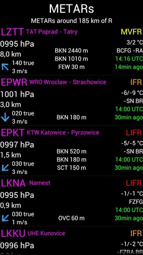
Tags:VOR, ILS, GPS, LOC, FIX, navigation, aviation, avionics, glass, cockpit, aircraft, plane, IFR, VFR, terrain alert, compass, altimeter, HSI, PFD, navigation aid database, altimeter, logger, declination, simulator, moving map, sunrise sunset calculator, RNAV, GPS ILS VOR glasscockpit, pressure, barometric sensor, baro altitude, VSI, airspaces, GPWS, METAR, TAF, radar, ADS-B